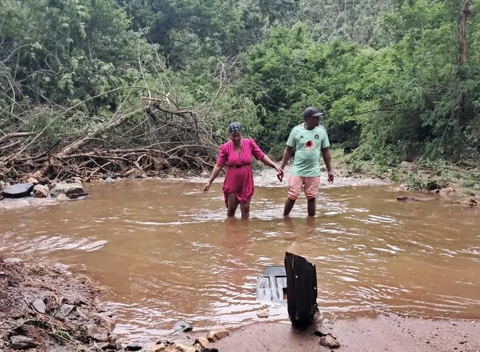
Emergency teams are assessing flood damage in parts of Limpopo after days of heavy rainfall, as the South African Weather Service maintains a Level 10 warning for disruptive rainfall across high-risk areas.
Image: Limpopo LEDET
A Red Level 10 warning for disruptive rainfall remains in place over parts of Limpopo and Mpumalanga as the risk of widespread and life-threatening flooding continues to intensify, the South African Weather Service (SAWS) has warned.
The warning comes as IOL reported that Cyril Ramaphosa visited flood-stricken areas of Limpopo to assess the extent of the damage and the government’s response, following days of heavy rainfall that have displaced communities, damaged infrastructure and disrupted essential services.
The Presidency has indicated that access to some affected areas remains limited due to flooded roads and ongoing rescue operations.
The warning follows several days of persistent and heavy rainfall that has already saturated catchments, with further downpours expected over the next 24 to 48 hours. SAWS said additional rainfall of between 100mm and 200mm is forecast in some areas, significantly increasing the likelihood of flooding.
According to SAWS, the areas most at risk include Maruleng and Ba-Phalaborwa local municipalities, Nkomazi Local Municipality, the City of Mbombela, Bushbuckridge Local Municipality, Greater Giyani, Greater Tzaneen, as well as Greater Letaba and Collins Chabane.
“The combination of very high amounts of rainfall already accumulated over the past several days, and the expectation of further heavy rainfall, means the risk of widespread flooding remains critically high,” said SAWS forecaster Lehlohonolo Thobela.
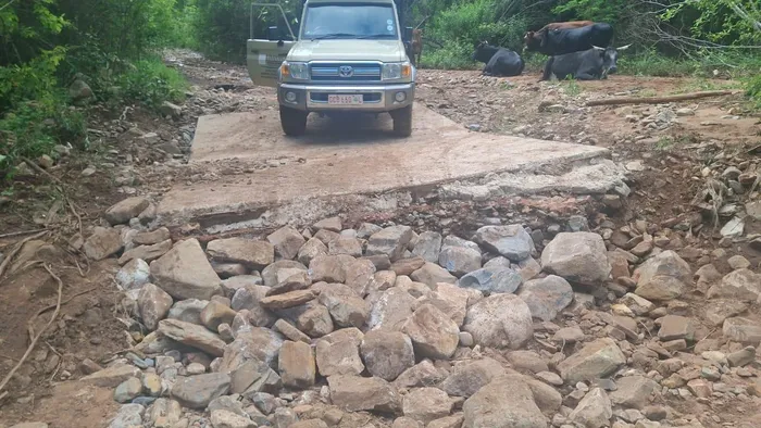
Emergency teams are assessing flood damage in parts of Limpopo after days of heavy rainfall, as the South African Weather Service maintains a Level 10 warning for disruptive rainfall across high-risk areas.
Image: Limpopo LEDET
He said the Level 10 warning would remain in place for as long as conditions posed a severe threat to life, livelihoods and infrastructure.
Potential impacts include fast-flowing rivers and streams that pose a danger to life, flooding of roads, bridges and low-lying crossings, widespread damage to settlements and property, disruption to critical infrastructure, and the possible displacement of communities.
Observed rainfall data from 11 to 12 January shows widespread accumulations of between 10mm and 50mm across affected regions, with higher totals of 50mm to 100mm and isolated areas recording between 100mm and 200mm, particularly over eastern Limpopo and eastern Mpumalanga.
SAWS said weather conditions are expected to gradually improve from around 19 January, with more stable conditions forecast from 20 January onwards, allowing river levels and saturated soils to slowly recede, but warned residents to remain cautious and follow guidance from disaster management authorities.
jonisayi.maromo@iol.co.za
IOL News