We could see a return to drought conditions beyond the 2025/26 summer season, especially if El Niño phases re-emerge, which historically bring below-normal rainfall and heat stress to South Africa’s rain-fed agricultural areas.
Image: Freepik
South Africa is entering a volatile weather period shaped by La Niña and a potential switch to El Niño, with major implications for agriculture, water security and disaster preparedness.
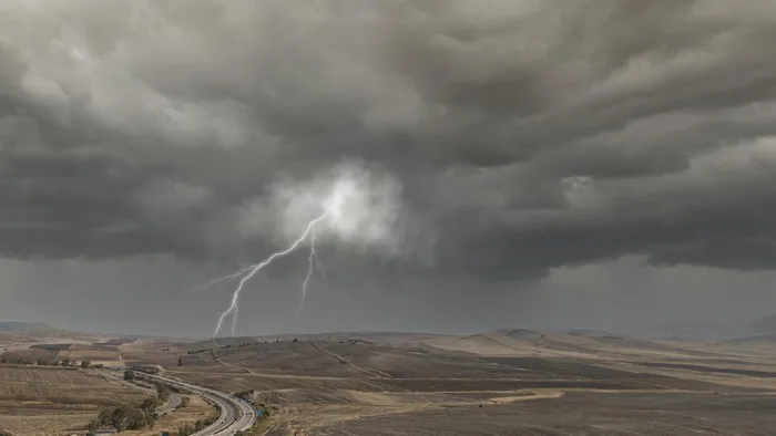
This comes as the South African Weather Service (SAWS) this weekend issued a severe weather alert for this afternoon.
SAWS issued an Orange Level 5 warning for extreme thunderstorms over the eastern Free State, eastern North West, Gauteng, western Limpopo, and the Highveld of Mpumalanga.
Heavy downpours and strong damaging winds are expected to cause flooding of roads, settlements and low-lying areas, as well as damage to infrastructure.
A Yellow Level 2 warning covers the extreme north-eastern Northern Cape, western Free State and North West, western KwaZulu-Natal, and the escarpments of Mpumalanga and Limpopo.
Here, thunderstorms are likely to bring localised flooding and damage, particularly on vulnerable roads, bridges and low-lying areas.
Other forecasts from the SAWS indicate above-normal rainfall across summer rainfall regions through February 2026, which could boost soil moisture.
It could also increase flooding, intense thunderstorms and crop stress in North West, Free State, KwaZulu‑Natal, and parts of the Eastern Cape.
Yet, the NWK Limited External Factors Report warns that we could see a return to drought conditions beyond the 2025/26 summer season, especially if El Niño phases re-emerge, which historically bring below-normal rainfall and heat stress to South Africa’s rain-fed agricultural areas.
Other experts warn that La Niña’s influence may fade from March 2026, raising the chance of neutral conditions and potentially drier spells later in the year.
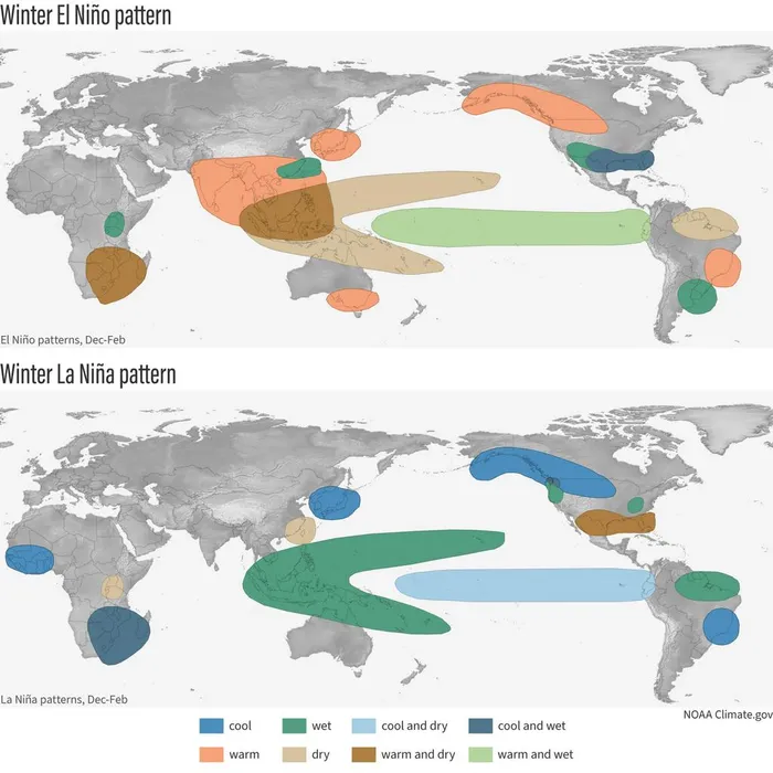
La Niña is the “cool phase” that usually brings wetter, stormier conditions, while El Niño, the warm phase, tends to bring drier, hotter weather.
These cycles are irregular, but when they occur, they can shift South Africa’s rainfall patterns dramatically.
Wandile Sihlobo, chief economist at the Agricultural Business Chamber (Agbiz), said in the fourth quarter of last year that La Niña rains can support maize, sorghum, sunflowers and pastures.
Too much rainfall too fast can damage infrastructure, erode soil, and delay planting. Early-summer moisture is vital for crop establishment, yet mid-to-late summer storms could disrupt yields.
Farmers’ outlook is mixed: summer crops like maize, sorghum and sunflowers may receive much-needed moisture, potentially boosting yields after the 2023/24 El Niño-induced drought that cut white maize output sharply.
Agriculture is a key sector helping drive South Africa's economic growth and is responsible for almost a million jobs.
La Niña’s influence may fade from March 2026, raising the chance of neutral conditions and potentially drier spells later in the year.
Image: climate.gov
The timing of wet and dry periods will be crucial. While early‑summer rains could support planting and pasture growth, mid-to-late summer storms may deliver flash floods and damage crops.
Western regions may see shifting rainfall patterns, with some areas at risk of below-average precipitation, exacerbating localised drought stress.
Farmers and authorities are urged to prepare for extremes, both wet and dry, balancing the benefits of early-season rains with the risks of flooding, soil waterlogging and crop loss, as South Africa navigates a season of climate contrasts and uncertainty.
IOL BUSINESS